A Day on the Southern and Scranton Divisions
by Allan F. Seebach Jr.
During my tenure as a fan and student of the O&W I have made many trips over the right-of-ways of the railroad. I have covered nearly the entire railroad at least once and visited other sections many times. During these trips I have found many new sites and points of interest and also saw some disappear. I take these trips mostly in the winter months for several reasons. One being that during this time you can see the railroad's remains through the de-foliated trees more easily. Another being, like Indiana Jones, I HATE SNAKES!
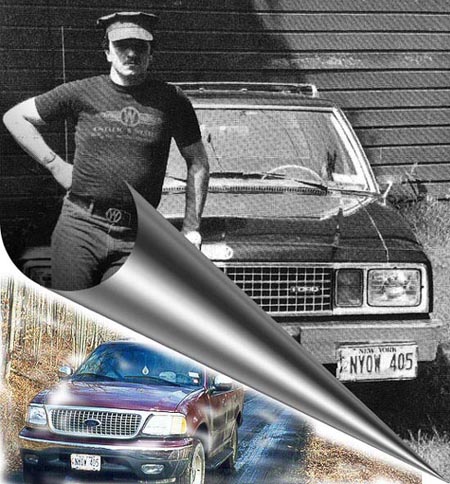
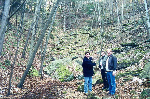
At the beginning of December I decided I needed an O&W fix and scheduled a trip with my son Matthew, Mike Murray and Bill Schneider. I decided to visit some Southern Division sites and then make my way down the Scranton Division which we did on December 18, 1999. We really enjoyed ourselves and I thought I would like to share what we saw with those who might like to see what's out there. I have mixed a number of "then and now" photographs in this article to try and give the reader/viewer a better perspective. Robert Mohowski, Bill Schneider and I took these photographs over the last 35 plus years. The O&WRHS Archives provided some photographs.
Our day began at 4:15 am on Saturday the 18th. Mike Murray arrived at our home at 5am and we were off to AV (Middletown) to meet up with Bill Schneider who was coming from Connecticut. We pulled into the archives center parking lot at 6 am to find Bill waiting for us We were off! As we rode west on Route 17 I pointed out landmarks of the O&W along the way to Roscoe. We enjoyed a hearty breakfast at the famous Roscoe Diner and talked about everything from where we were going to modeling the railroad. At this point the sun had risen enough to take pictures.
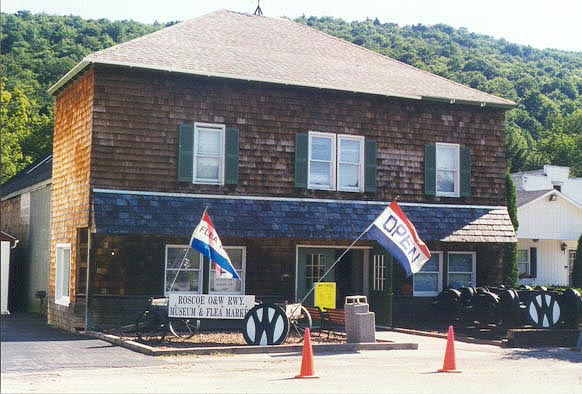
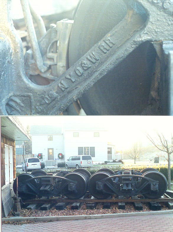
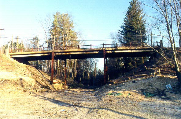
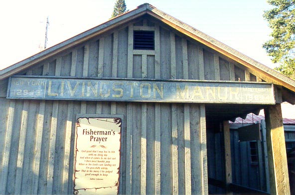
Bill wanted a few shot of the old Roscoe Lumber yard (1) near the wye and some of the structures near where the Roscoe station was located. We stopped at the Roscoe O&W Museum and saw the trucks from the O&W caboose No. 8360 . At this point we doubled back to Livingston Manor and checked out the freight house, which Bill has just scratch built in HO scale. (See Bill's article on the society web site) We also photographed the Livingston Manor Coal Co. scale house and silo remains for a future model project. We drove down Creamery Rd along the O&W to Covered Bridge Rd. and saw the Road Bridge over the right-of-way. This structure was built in the early 40's; I have been told this bridge is in the process of being eliminated. Doubling back into town we tried to check out the old Manor rail yard but were met by some "not so happy to see us" watch dogs, we quickly left as we came. On a side street off of Main St. there is a park where we saw the original Livingston Manor station sign . We jumped back on Route 17 west and got off at the Cooks Falls exit. We headed east on Cooks Falls Road until we saw the double through truss bridges at Hair Pull; we turned back and made a left on Cooks Brook Road at the bridge over the Beaver Kill River. The old Creamery site is just to the left of the bridge, the house that now sits on the water tank foundation and the station are to the right, today, and they are private residences.
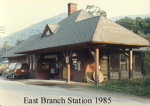
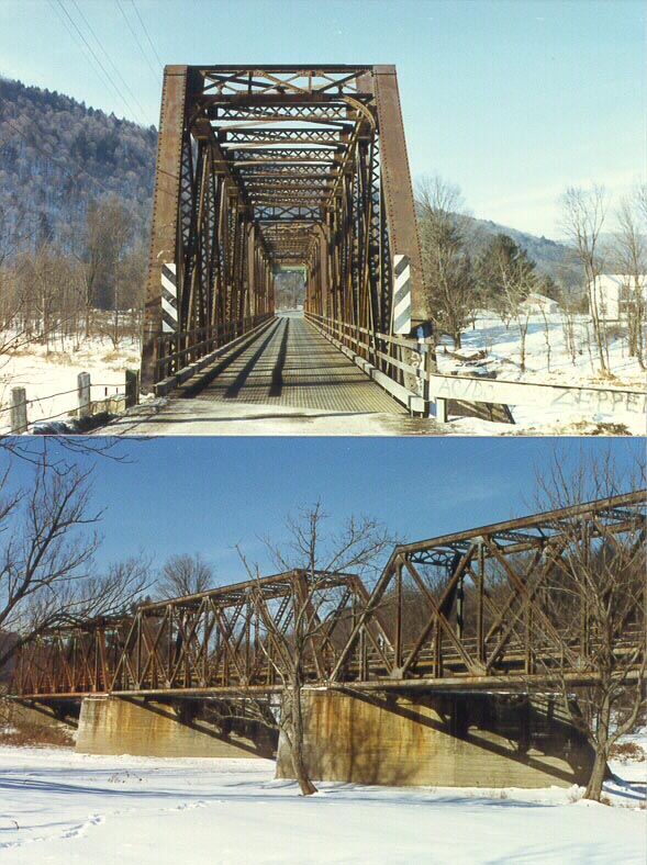
We made our way back toward Route 17 but kept to our left along the Beaver Kill and the railroad. (This is Old Route 17) to East Branch where we made a left over the river and made a left on O&W Road. (Once the roadbed and now a street through the center of town.) We went as far as we could and saw a railroad bridge adapted for auto use. Doubling back we saw a crossing shanty in the Johnston and Rodes Bluestone yard. I gave a description of the East Branch station, which was located by the Firemen's Monument (locomotive tire fire alarm.) The station was burned by an arsonist a number of years ago. I was lucky enough to have been in it several times. We continued on the right-of-way along the Beaver Kill River to Fish's Eddy where we then crossed the river on the O&W's through truss bridges.
Getting back on old 17 we followed the roadbed until we were about a mile away from Hawk's Mountain Tunnel, when all of a sudden my Expedition saw a place where it could get on the right-of-way and before we knew it we were traveling on uncharted territory. To our left was the east branch of the Delaware River and some beautiful scenery. We went about a half-mile before a felled tree and washout stopped us. At this point we continued on foot along the river to the south portal of the tunnel. On our way at about MP158 we came across the footings for the Acme Lumber Company cableway , which spanned over the main line. At one point we had to walk along the riverbank because the right-of-way had been covered with rock and fill from new Route 17. Upon reaching the approach to the tunnel you pass Hawk's Mountain tower on the left. (There are no noticeable signs of the tower) As you enter the cut there really is not much to see (This was my third visit) the portal has been covered over by tons of rock blasted out of the mountain to make the cut for Route 17. You can sense by the slopes as to the location of the portal. Today the area is tree covered and damp. The rocks are covered with moss and there is a constant stream of water running out of the tunnel from under the rocks. It is kind of eerie and the scenes along the river are spectacular.
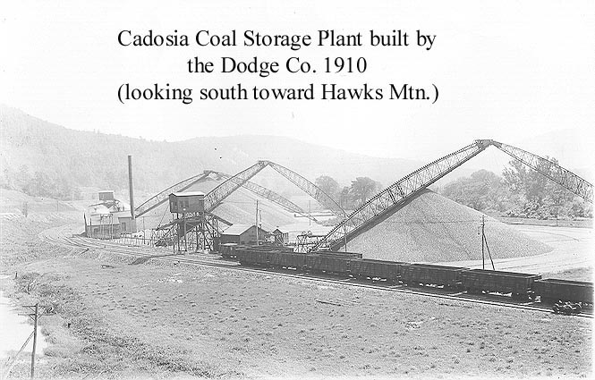
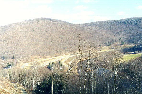
We made our way back to the car and onto old route 17 heading toward Cadosia. We stopped in the (old and new) Route 17 cut above Hawk's Mountain Tunnel and I pointed out a few landmarks from this high elevation. At this point I gave the guys a guided tour of the entire Cadosia and Hancock area. (I am not bragging but I know a lot about this area) We went down Green Flats Road and visited the north portal of the tunnel and the coal storage plant . I pointed out the south yard, which is now a part of Route 17 and the north yard. (Now Cadosia Apex Road) We also saw the station grounds, bridge 170's original location, the Cadosia Water Company and of course we had to stop in and say hello to Frank Posemato at the "Do Drop Inn". The railroaders use to socialize and "layover" at the Inn. Frank's family has owned the Inn since prohibition was repealed.
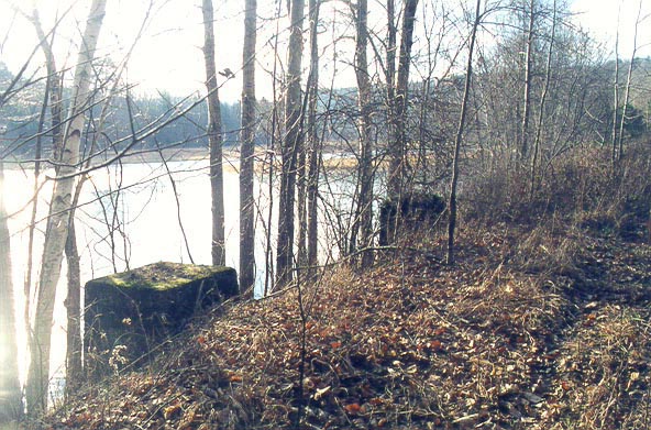
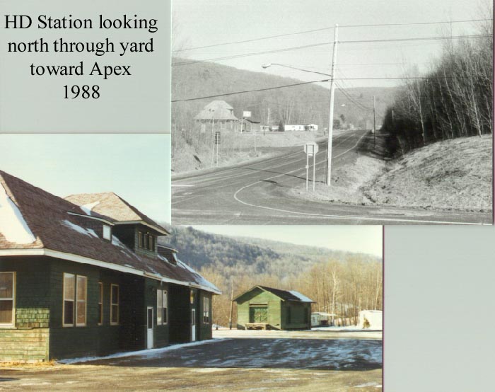
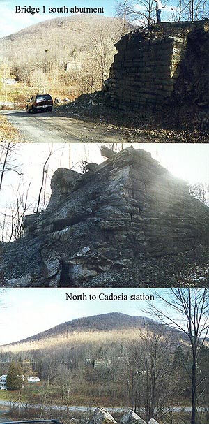
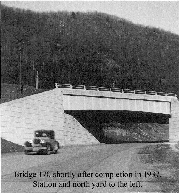
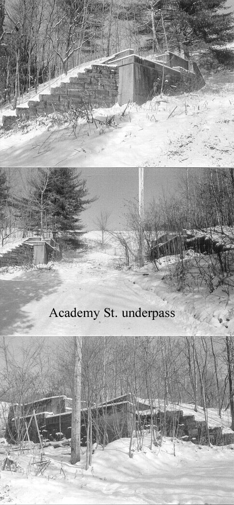
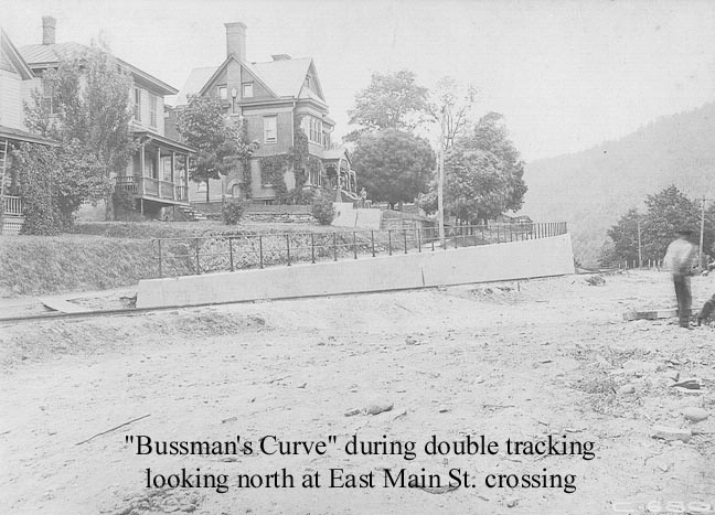
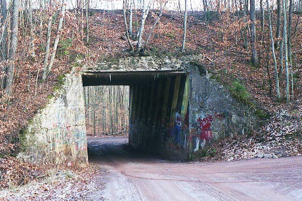
After leaving the Inn we went down Snake Creek Road and turned left on the Cadosia road toward Bridge No. 1 on the Scranton Division. Both abutments are still visible as well as a few of the piers. Much to my surprise someone cut a road in along side of the south abutment and in doing so had to remove a portion of the concrete, which was added in 1916 when the bridge was double-tracked. Because of this you can now see the original cut stone abutment constructed in 1890. We traveled up this new road a bit and got a new view of the Delaware's east branch and the south yard . Returning back to Cadosia road and making a right I showed my students Bridge 170's current location over Cadosia Creek . The original bridge had been built in 1904 and was replaced in 1937 . Being in fine condition in the early 1960's it was salvaged and re-used over Cadosia Creek when new Route 17 was built. We followed old Route 17 (East Front Street) into Hancock and turned right on Academy Street to see the Academy Street over pass and Bussmans Curve (Photo 1 , Photo 2 & Photo 3). We followed the right-of-way winding through the streets and along the school property to Pennsylvania Ave. making a right we saw where the station was located. (Unfortunately everything was blasted away and Route 17 is under the station.)
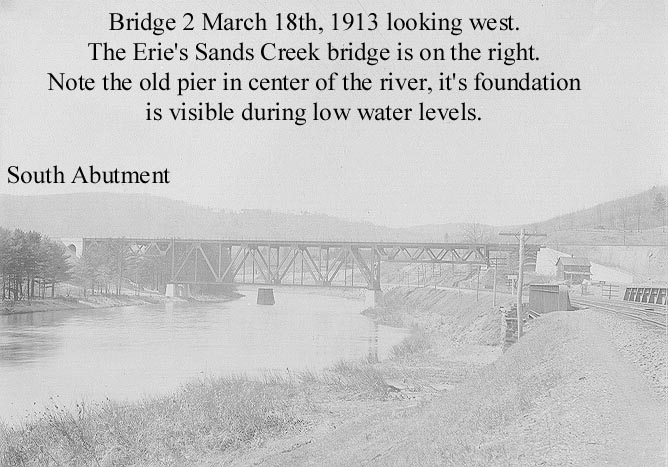
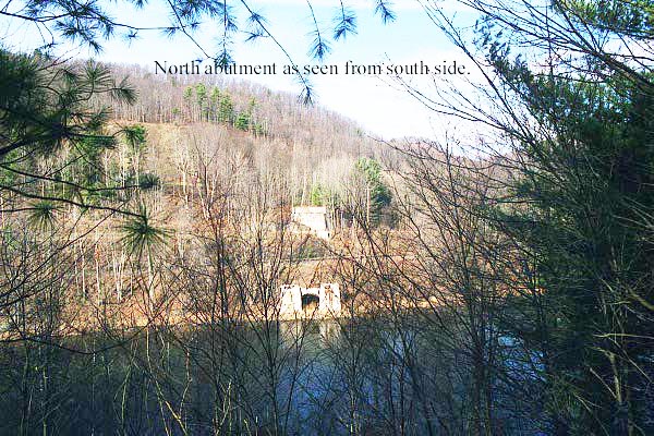
We made our way out to West Front Street, turning right. Then turning right on Sands Creek Road, where we saw the location of the Sands Creek Trestle and it's remaining south abutment, which is on the left bank above the highway maintenance building. Re-tracking our steps we turned right off of Sands Creek Road and went a quarter mile to the north abutment of Bridge # 2 over the West Branch of the Delaware River (Photo 1 & Photo 2). The abutments are all that exist and they are huge! Again, back-tracking our steps we followed along West Front Street and the ex-Erie Southern Tier line (Now NS) and crossed the tracks to Route 191 in Pennsylvania. At the sign "Welcoming you to PA" you turn right on Winterdale Road and follow the road around to a sharp turn. The south end of Bridge 2 is on your right. We walked out to the south abutment and it was awesome! (Looking over the left bank of the fill you can see several pieces of the original iron trestle built in 1890! The railroad/highway overpass had been removed about eight years ago for safety reasons. Fortunately I got to see it on one of my first Scranton trips.
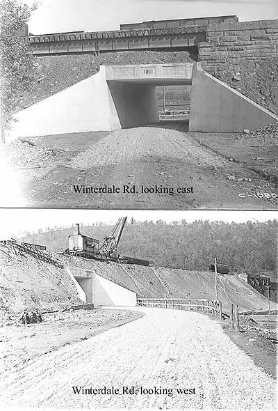
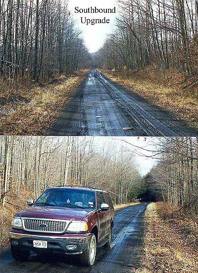
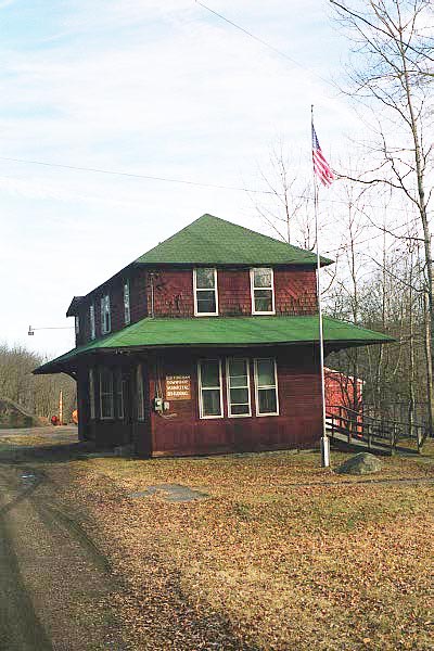
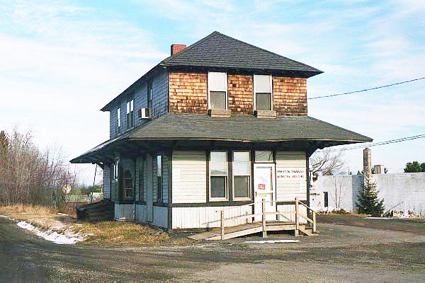
At this point you can jump onto the roadbed and drive clear to Starlight station. (The local municipality currently uses the station.) Along the way you cross over Jones' and Fall's Creek Trestles which were filled during the double tracking project.You have to look for them, as all they are now are several culverts and underpasses. Despite the optical illusion some people experience you are going up-grade all the way to Poyntelle and it is steep! Crossing the road after Starlight Station you can't go much farther due to and earthen bank placed across the roadbed. Just a bit farther and you would be at another trestle which was filled around 1902 before double tracking and since dug out. Making a left at the crossing you then make a right on Route 370 (The railroad remains on your right) You come to a crossing of the roadbed and make a left and you're next stop is Lakewood Station which, is also used by the municipality. Continuing on, your next stop is Poyntelle where there was a station and a wye for turning the pushers. The only landmarks are an old hotel and some type of lumber shed.
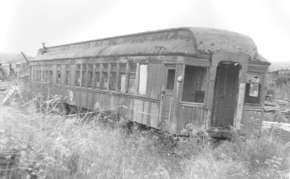
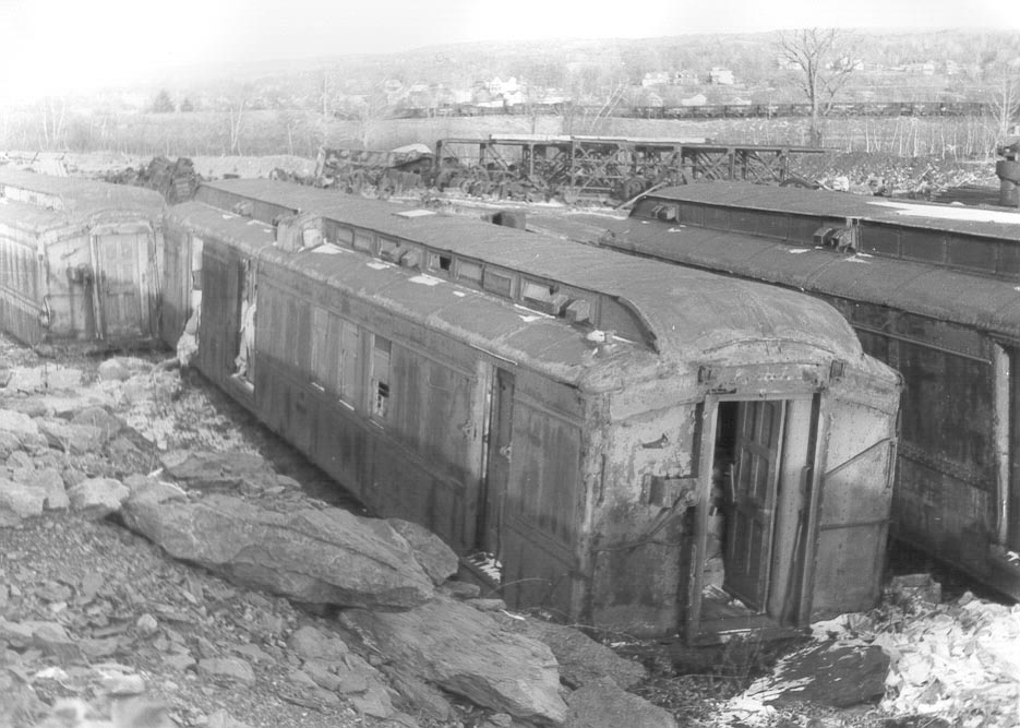
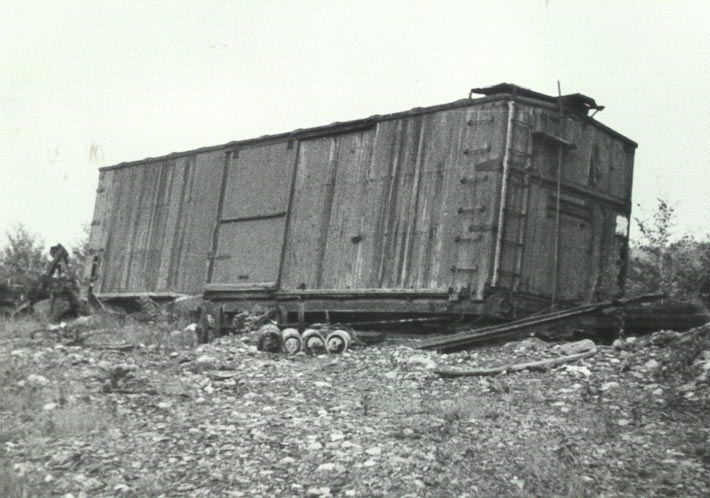
It is now about 2pm and we are running out of daylight and we wanted to spend some time in the Mayfield area before it got to dark to take pictures. Making a left turn onto Route 370 we continued to the end and made a left onto Route 171. I set the throttle in the 8th notch and we continue south. The railroad and the highway more or less parallel each other with the railroad being on the left. In a lot of areas you can identify where the O&W was by the tree line and the noticeable grades. We passed the O&W towns of Orson, Pleasant Mount and Uniondale. As you get nearer to Forest City you will notice a second abandoned rail line. This is the Ex-Erie Railroad, Delaware and Hudson Jefferson Branch. We continued through Carbondale, turning right on Route 6. (To get to the Carbondale Trestle and the D&H yards you would make a right on Salem off of Route 6 and then a right on Dundaff St. Some of the abutments of the long O&W trestle are all that remain, After you pass the trestle and cross the D&H the yard is to the right.) Unfortunately we did not have time so we continued on Old Route 6 to Mayfield and stopped at the yard site across from Baumann's junkyard, which is partly in the Mayfield Yard. There we saw the sad burned out remains of a 1903 truss rod coach number 217. This car became W18 and was used in work train service until the road closed in 1957 . In addition we saw the rusting remains of two of the Osgood Bradley RPO's. One (No. 170) is in its (now very rusted and faded) original deep green paint scheme and the other is in the gray diesel scheme (Photo 1, Photo 2, & Photo 3) There are a couple of truss rod boxcars (probably 9000's) and one 5000 series steel frame boxcar No. 5267.
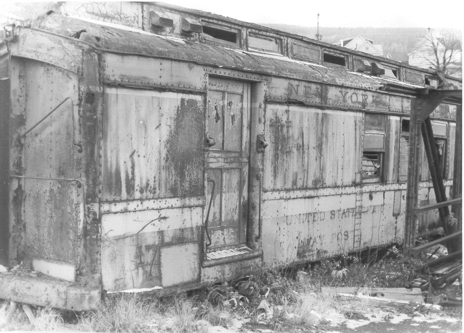
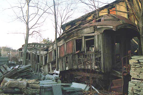
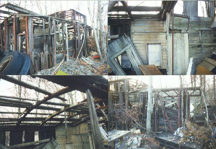
Across the street next to the Baumann's store is a truss-rod wood coach, which has seen better day's . The skeletal remains of caboose No. 8307 sits up behind some houses near by . To the left of the Baumann's building is an O&W 1000 series milk car, which for a time was used as a post office and a short distance farther down Old Route 6 you bare left on "Back Road" heading south, where you will see a school on your left that has been built on the site of the Mayfield roundhouse and shop facilities. At the end of this road we made a left on Division and a right on Lackawanna Ave.
Leaving Mayfield we passed through Jermyn, Archbald, Winton, my father-in-laws hometown of Peckville , Olyphant, Dickson City, Throop, Providence, Park Place and Scranton. All of these places still clearly show the presence of the O&W and it all is worth looking for. If you had the time you could trace out most of the mine branches and coal breakers as well. I would be remiss if I did not mention Steamtown. The national Parks Service is doing a fine job of preserving railroad history and it is worth the trip to Scranton.
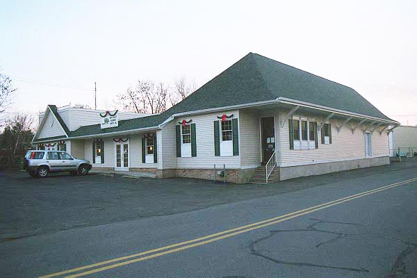
By now it is getting pretty dark and we have a long ride home; we will have traveled over 300 miles. We were all a bit hungry, not having had any fuel since the early morning, but we opt to wait and stop at the Rusty Nail Restaurant in Mechanicstown just east of Middletown. This restaurant was once the Mechanicstown station on the O&W and I could not think of a more fitting way to end a great day of Owen-W-ing. I was once quoted by the Wall Street Journal in a 1987 article about the society, saying, "This stuff is better than drugs any day". Boy...I can't wait till my next O&W fix! Allan F. Seebach, Jr.A couple of notes:
From Cooks Falls to Hancock, especially in the Hancock/Cadosia area there are Rattlesnakes, and they are big! If you do not believe me look on the walls of the "Do Drop Inn."
Many of the places visited are private property, respect it, a shotgun blast HURTS! For those not familiar with these areas you can contact the society sales department and purchase trip (bus tour) guides, which will help you navigate some areas. Happy Rail fanning and may Owen be with you!
For some great satellite views of the Hancock & Scranton Division visit these sites on the Internet: